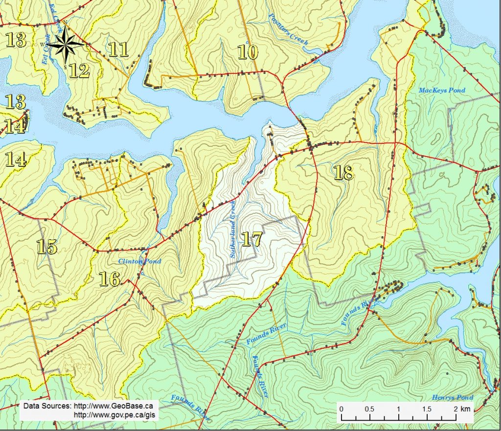
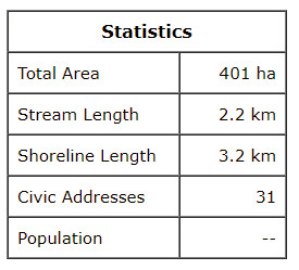
The Sutherland Creek watershed is situated in the eastern third of the Clinton district and the northern part of the Grahams Road district. The highest elevations of 75 m are found at the southwest corner of the area. The land generally slopes northward to the Southwest River estuary. It is the smallest of the Kensington North watersheds, making up less than 2% of the total area.
Sutherland Creek begins north of Grahams Road and flows north roughly parallel to the Grahams Rd. for about 2.1 km before emptying into the estuary on the north side of Rte. 6. The Sutherland Creekestuary is about 1.0 km long. Several small tributaries enter the main stream from the east and west.
The steep banks of the Sutherland Creek estuary is a dramatic feature that is uncommon in our area. These steep, treed slopes are an attractive portion of the drive along Rte. 6. The land is used for mixed farming and much of the high slopes are well treed.