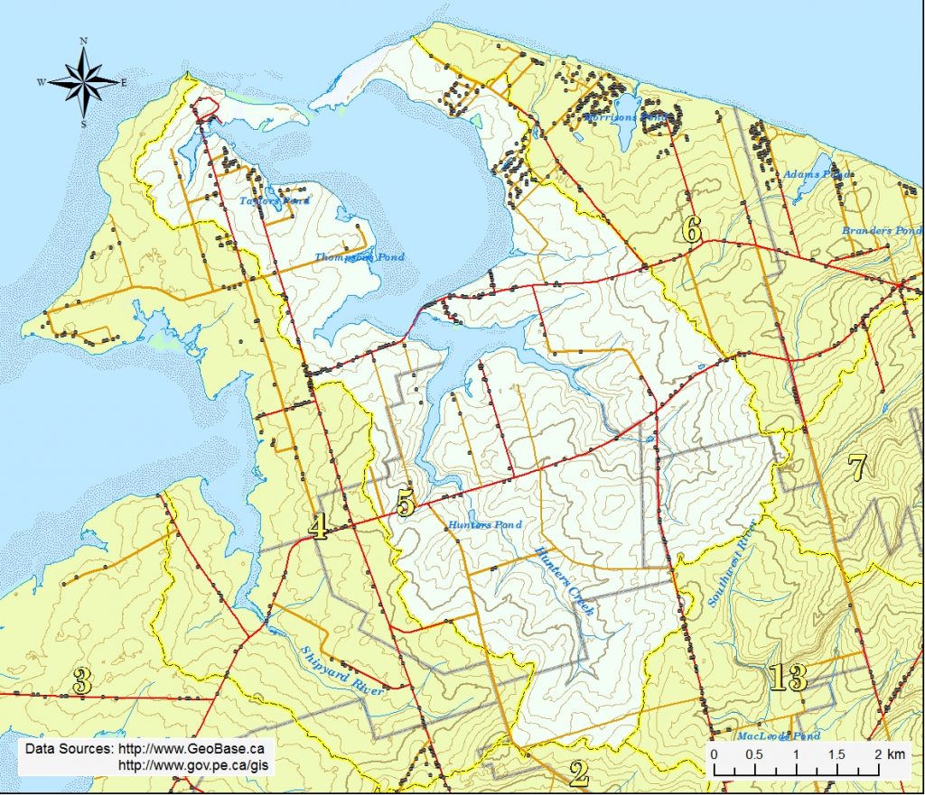
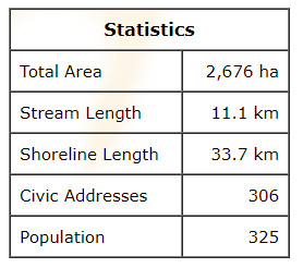
The Darnley Basin watershed is situated in the eastern half of Malpeque, the west half of Darnley, the eastern three-quarters of Baltic and the northern quarter of Spring Valley. The highest elevation of 58 m is found at the east side at the north end of Spring Valley. Other high points are found on the Spring Valley Rd (Rte 102) north of the Hall Rd (52 m) and west of the Old Princetown Rd (56 m). The land generally slopes northward into Darnley Basin.
There are three main sub-watersheds, the Baltic River, Hunters Creek and the west basin area. The Baltic River starts in the high lands east of the Spring Valley Rd (Rte 102) south of Rte 103. It is about 2.1 km long and flows under the Spring Valley Rd into Murrays Pond, through some wooded land straddling Rte 103 before it reaches the estuary and Darnley Basin. There are several secondary branches totalling about 1.1 km long on the east side of the main branch. Baltic River has a wide riparian zone.
Hunters Creek starts in mixed woods north of the Hall Rd in Spring Valley. Along its 3.0 km length it flows under the Matthews Rd, through farm land under the cover of heavy alders and into Hunters Pond, and then under Rte. 103 into the estuary and Darnley Basin. There are several secondary branches totalling about 2.2 km long on both sides of the main branch and estuary.
The west basin area is a collection of shoreline-direct streams totalling about 1.0 km that drain generally eastward into several small salt water ponds and tidal marshes on the west side of Darnley Basin between Rte 20 and Malpeque Harbour. These include Malpeque Harbour, Taylors Pond and Thompsons Pond