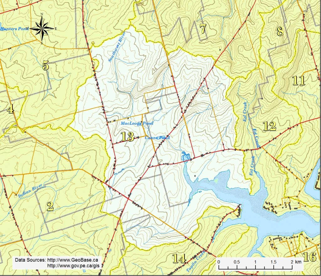
The Spring Valley Brook watershed is situated in the western side of the Long River district, all of Burlington, the east half of Spring Valley and the northern quarter of Margate. The highest elevations of 44 to 100 m are found along the north side of the area. The land generally slopes toward the south and then eastward into the Southwest River estuary.
The main freshwater section of the Southwest River, known to some locally as the Spring Valley Brook, starts in the wooded highlands of Spring Valley west of the County Line Rd. The brook runs southeastward about 5.1 km through steep sloped fields, under the Leards Mill Rd and into Leards Pond. It crosses under the MacEachern Rd, past the junction of two large tributaries and into Canns (Davis) Pond. It then flows under the Irishtown Rd (Rte 101), meets another tributary before it enters Warrens Pond on the north side of the Burlington Rd (Rte 234). A short passage under the road leads to the estuary. Altogether, the tributaries off the main stream total approximately 8.1 km in length.
Another small branch of the Southwest River flows east and then northeast about 2.2 km from fields south of the Irishtown Rd / Rte 104 intersection, crosses under Rte 104 and enters the south side of the estuary.
The Spring Valley Brook watershed lies in the heart of the KNWSA. It is a complex system, made up of a mixture of steep and rolling terrain, three large ponds, productive agriculture land, and a strong community.