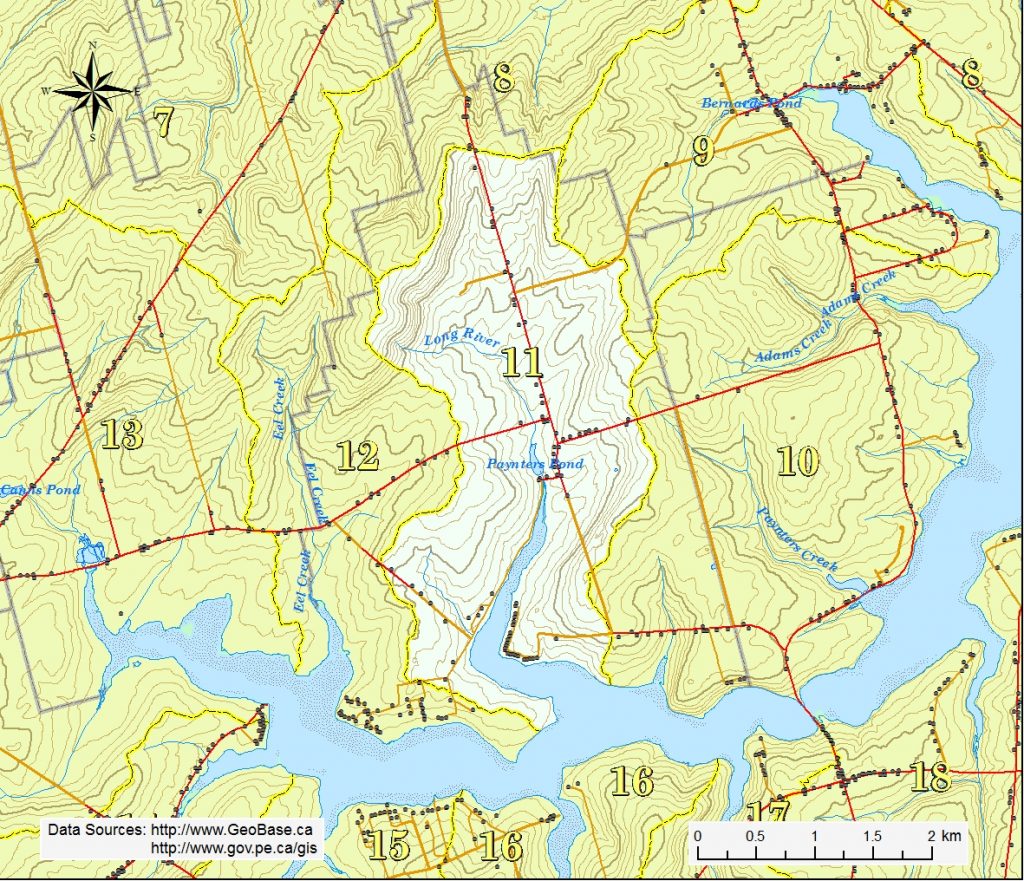
The Long River watershed is situated in the central half of Long River district. The highest elevations of 74 to 98 m are found at the north end of the area. The land generally slopes southward to the Southwest River estuary.
The Long River system, about 1.2 km in length, starts northwest of the intersection of the Burlington Rd (Rte 234) and the Long River Rd (Rte 262). It passes under the Burlington Rd, through Paynters Pond before draining into a 2.3 km long estuary and then the Southwest River.