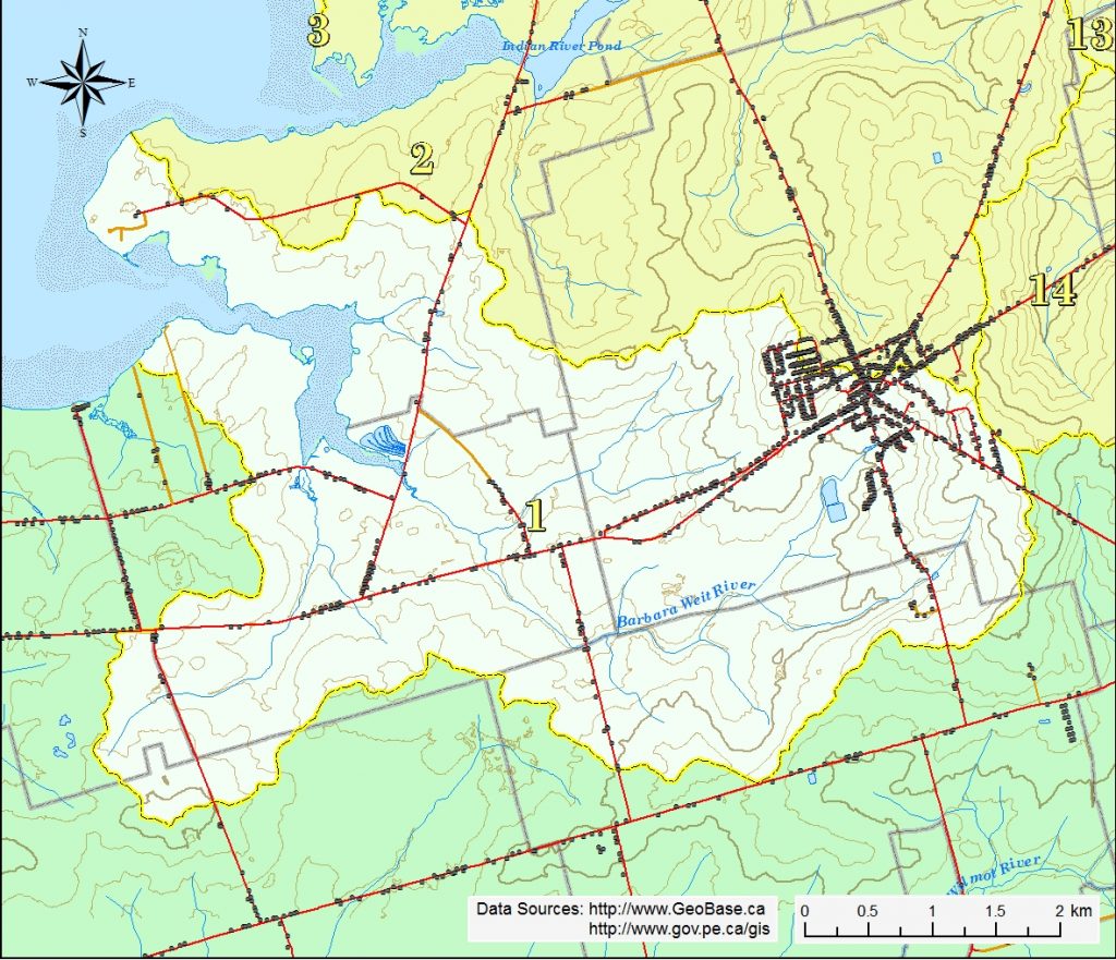
This watershed is situated in the eastern three quarters of New Annan, the southern halves of Clermont and Kensington and the northern quarter of Kevin Grove school districts. It generally slopes westward from the highest elevation of 58 m is found east of Andrews Dr. in the Town of Kensington towards Malpeque Bay.
The Barbara Weit River has three main branches; the longest branch has two primary sources in and just south of Kensington and drains westward 6.5 km (plus 2.4 km from the second source) flowing under the MacIntyre Rd (Rte 110) and Route 2, passing by the Cavendish Farms plants in New Annan, finally emptying into Barbara Weit estuary west of the Clermont Rd (Rte 106). The west branch starts south of Route 2 beside the Confederation Trail and flows north 2.2 km eventually draining into the estuary where it flows under the Barbara Weit Rd (Rte 180). The third branch has its source in the farmland west of Kensington, flows 1.3 km under the Old Station Rd (Rte 110) and joins the main branch of the river just north of the Confederation Trail. There are several other short unnamed streams under 0.5 km that flow directly into the estuary. The main estuary is about 3 km long and drains northwest into Malpeque Bay.