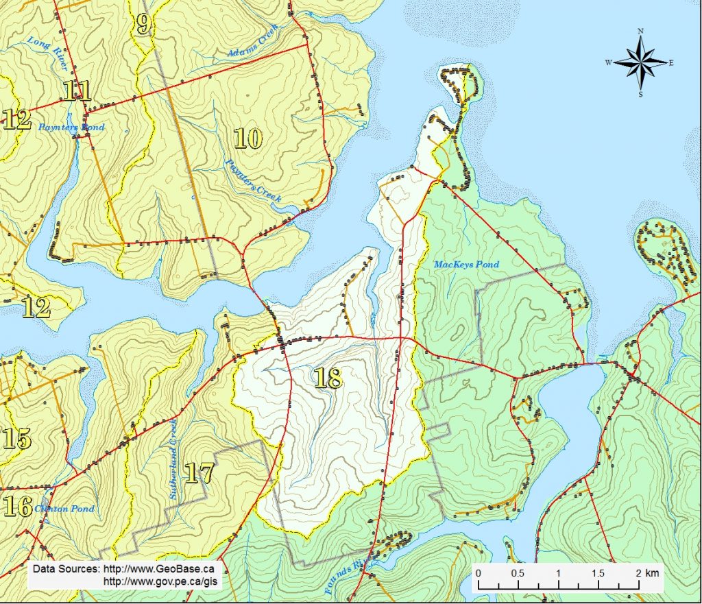
The MacIntyres Creek watershed is situated in the western half of the New London district with a small portion at the south end extending into the Grahams Road district. The highest elevations of 65 to 66 m are found at the south end of the area. The land generally slopes northeastward to the Southwest River estuary.
MacIntyres Creek begins on the west side of the Fountain Rd. between Founds Mills and Rte 6. It flows about 1.7 km in a northerly direction to the estuary. The estuary itself is about 1.4 km long. Before it flows under Rte. 6, it is joined by its main tributary which begins on the east side of the Grahams Rd. between New London and Grahams Road. This branch is about is about 2.5 km long. The gently rolling hills are good potato land with forest cover through much of the riparian zone.
This area was once home to a profitable ship building industry. In the mid 1800’s, ships were built here on the banks of this small estuary with local timber and sailed to the England.