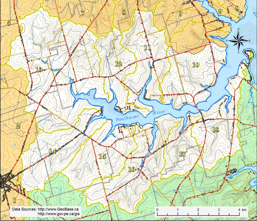
The Southwest River watershed is an aggregation of seven smaller watersheds plus the major portion of two other small watersheds at its mouth in New London Bay. It includes Paynters Creek, Long River, Eel Creek, Spring Valley Brook, Tuplin Creek, Durant Creek, Harding Creek, Sutherland Creek and most of MacIntyres Creek (excluding the north side of McEwens Island). Adams Creek, technically, is not part of the Southwest River watershed because it empties directly into New London Bay.
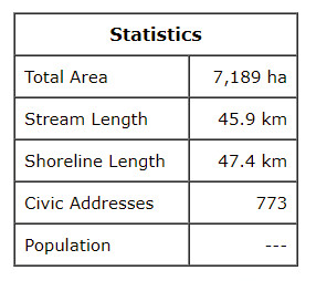
The Southwest River estuary is about 11.6 km long from the mouth of the Spring Valley Brook to its mouth between Lockes Point and McEwen Island. The whole estuary, including the those of the smaller watersheds, covers about 690 ha. A bridge at New London separates the estuary into two major areas. The upper / inner estuary covers about 440 ha or 64% of the total area, while the lower / outer estuary covers about 250 ha or 36% of the total area.
The saltwater estuary includes all of the shoreline in Burlington, Clinton, Margate and Long River districts and large portions of the shoreline in New London and Springbrook. The highest elevation of 100 m is found on the north side of the river at the junction of the Long River and Eel Creek boundaries with the Campbells Pond boundary. On the south side the highest elevation of 84 m is found on the south side of the Harding Creek watershed boundary. The highest land separating the Southwest River watershed from those flowing north to Darnley Basin and west to Malpeque Bay ranges from 54 m in the north to 59 m in Kensington. The lowest land on this divide is about 29 m in elevation south of the intersection of Rte 104 and the Spring Valley Rd. (Rte. 102). The basin generally slopes eastward to the New London bridge and then northeastward to New London Bay.